Upper New York Bay
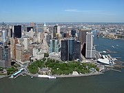
L'Upper New York Bay, que s'anomena de vegades Upper New York Harbor és la part nord de l'espai marítim delimitat per New York. L'Upper New York Bay engloba així Manhattan, Long Island, Staten Island, així com les ribes de Nova Jersey. La badia és s'acaba en un estret on el Hudson River desemboca a l'oceà Atlàntic. A l'Upper New York Bay hi ha nombroses illes, entre les quals Governors Island, Liberty Island, o fins i tot Ellis Island.
Read article